

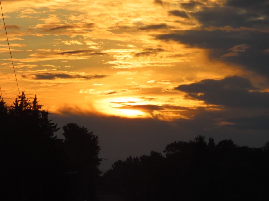
I was awake super early today and rather than crawling back under the covers for more sleep, I decided to get a jump on the day. I packed a lunch and gathered all of my paddling gear and loaded it up for a day of exploring Lake Superior and leaf peeping up along the western shore. A liquid bronze sunrise was waiting for me as I exited the campground.
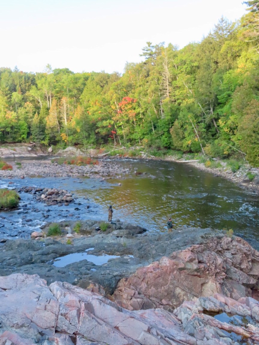
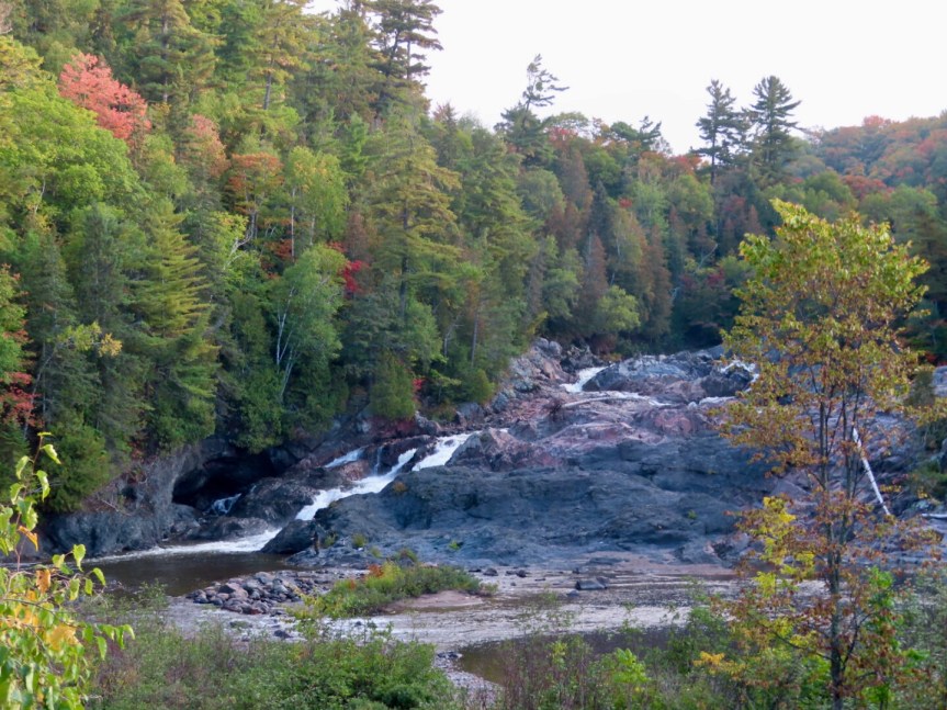
I wandered up Trans-Canada 17 until I came to the Chippewa Falls rest area. There is a plaque commemorating the half way point of the original highway that runs east to west across this magnificent country. I hiked the short trail out to the rocky outcrop of the falls. Being the end of summer, the volume of water coming down is low but they were still a work of natural art to behold. Speaking of art, there was a little plaque with a small artist chair where the group of seven had painted the falls on their tour around Ontario in their train car many years ago. We had seen the train car the other day outside the old mill buildings in Sault Ste Marie. Some fishermen were casting their lines in the pool at the bottom, standing nearly waist deep in the river wearing their rubber pants.

I met an affable local fisherman in the parking lot, and he recommended passing by Pancake State Park and putting into the lake a few miles further up at a small beach across from an old motel. The shoreline is rocky and has more character, he surmised. Paddling the lake and hiking up the Edmund Fitzgerald trail to the overlook were my main objectives starting out. He suggested paddling first before the wind became an issue. We chatted for a while then I took his advice and parked up along the highway at the opening he described and got the SUP out on the calm, ultra clear waters of Lake Superior.

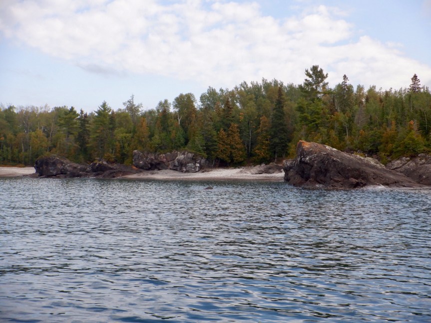

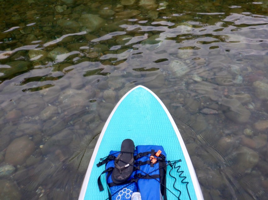
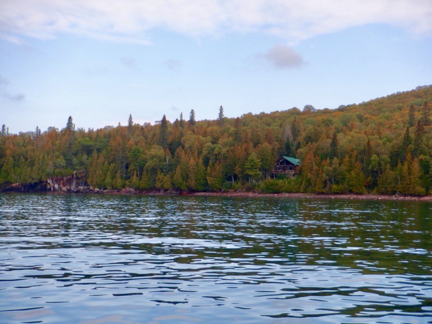
Lake Superior is the largest of the Great Lakes and northernmost. It is actually the largest freshwater lake in the world. Equal in size to South Carolina, it felt like an ocean moving along the coast. Although there was no wind, there were steady swells that moved the surface like a sea. At 350 miles in length, it can regularly get waves of up to 20 feet during winter storms. I paddled south towards the state park wanting to see their famous three kilometer stretch of sandy beach. Every time I’d round one point thinking it would be around the corner, another rocky point a ways down the coast would present itself. I kept going, passing large rocky outcrops, small beaches and tree lined shores. After an hour, I finally swung around the final point and could see the crescent beach of Pancake Bay. The visibility is so fine that the bottom is easily seen up to 12 or 15 feet in depth. Large granite boulders and rocky bottom gave way to smaller rocks then sand as I moved into the bay. A beautiful morning and I was the only person on this huge lake, at least on these few miles of shoreline. I turned back and retraced my wake back to the parking area. An awe inspiring paddle on an awe inspiring lake.


After the exercise and my usual polar plunge into the lake near the end of the paddle, I was wide awake and ready for more exploring. At the trailhead to hike up to the lookout, they required a park pass for your vehicle. I drove to the park entrance and they wanted $15.50 for a day pass. A little steep for a quick hike, so I passed and started driving back towards the Soo. A few miles south of Pancake, I took a small road out to Batchawana Bay passing small homes and a tribal community center. I stopped at the lakefront cemetery for the view and to look at the old wooden crosses marking the burial sites. After checking out the German hotel at the point, I stopped at the little utilized dock and walked out on the planks.


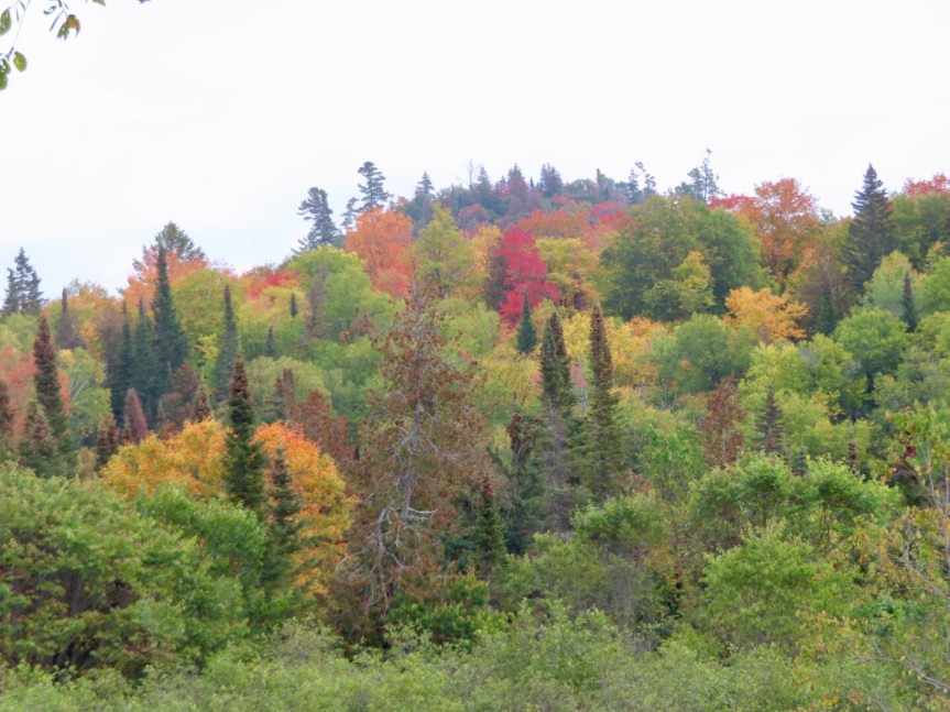
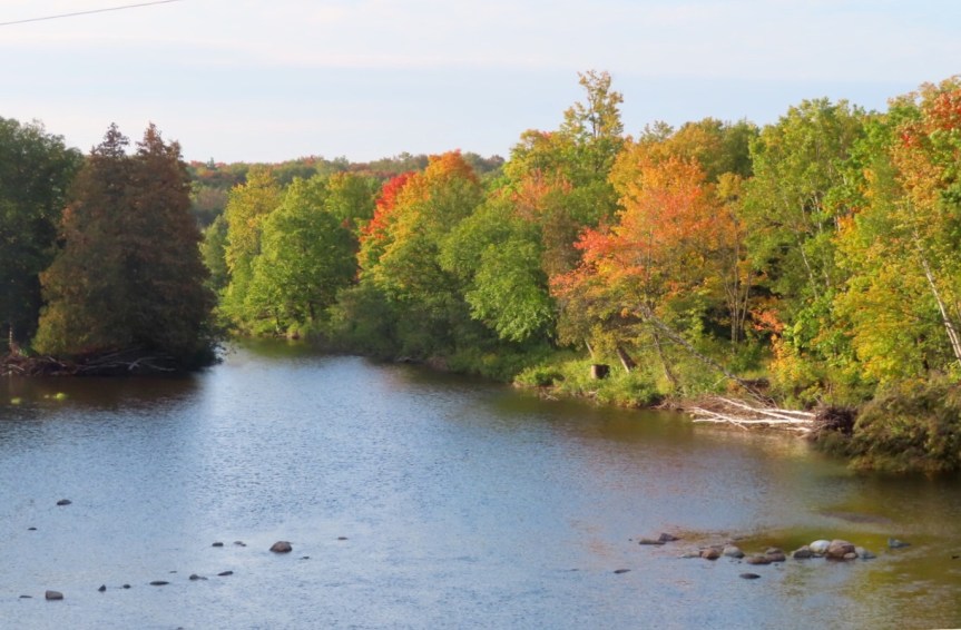
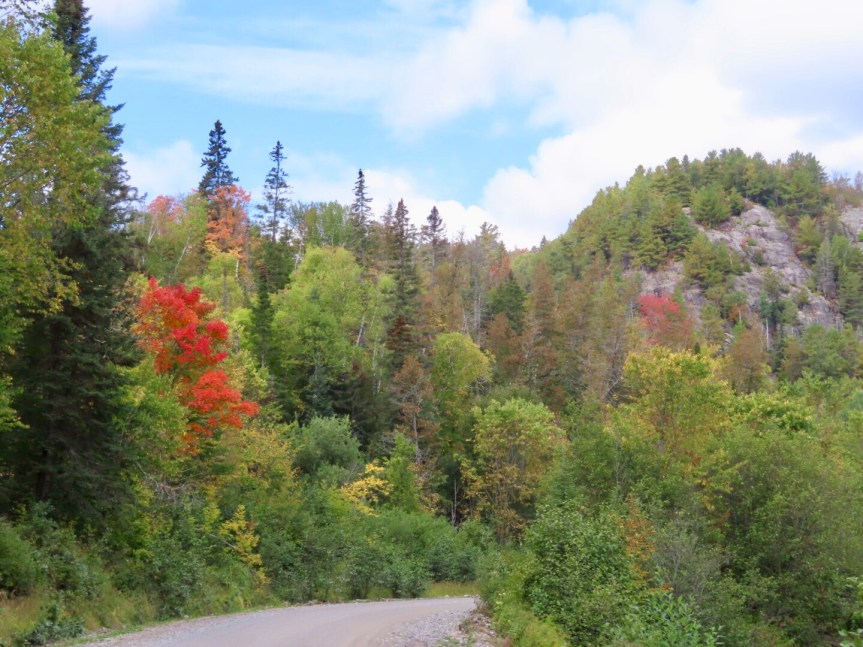
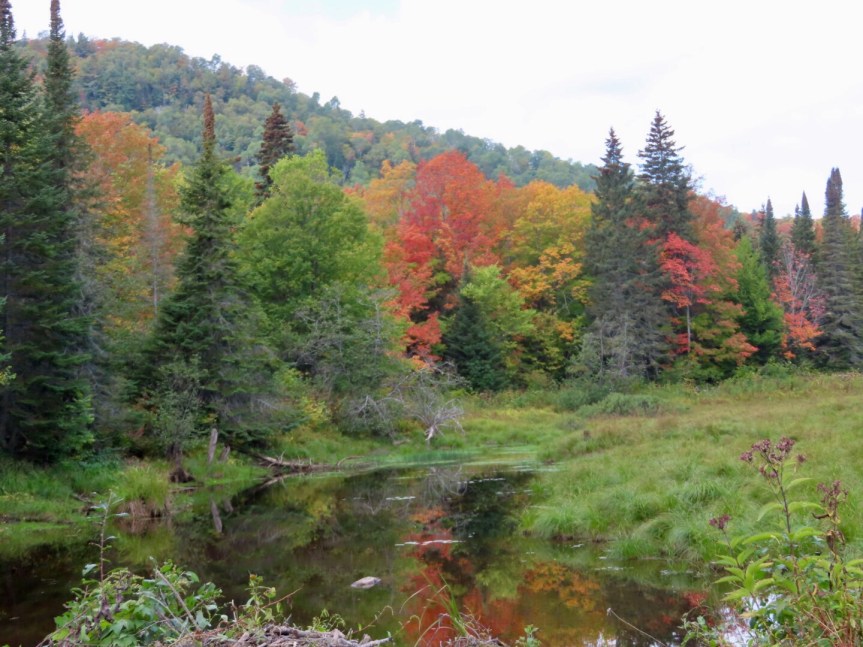
My aim at the start was to catch some fall colors, but it seems I may have jumped the gun by a few days. In most the areas only a moderate percentage of the trees had changed color. It’s a fine balance to catch the “peek” of the colors since the red maples go off first then yellow birches and other trees at slightly different schedules. You want to catch the others in color before the reds drop and leave only the oranges and yellows. I saw quite a bit of color up on the hill side to the east, so I slid onto a narrow logging road and headed up into the forest. Beautiful, beautiful, beautiful. Brilliant trees lining small ponds and rivers with granite cliff faces for a back drop. I kept being drawn further and further in wondering what new scenery was waiting around the next bend. I was hoping for an overlook at the top, but the trees kept a close guard on either side of the road denying any long range vistas.


I saw only a few stray pick up trucks going in as I poked along the dirt track. I would stop often and get out to take in the views and listen to the bird song. On the way out I did encounter a logging truck, but he was going easy and waved me to pass. A far cry from the murderous big rigs that would barrel down on you in a cloud of dust back in Maine. It was over an hour for the seven miles in and out but well worth the time spent.


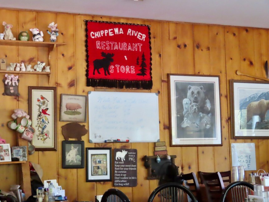
By now, I had worked up a hearty appetite and since a cross country trucker on highway 17 was intent on climbing into my trunk, I took the next pull off to get out of the way and it happened to be in the lot of the Chippewa River Restaurant & Store. Divine providence you might think. An old school country diner, they offered a Friday fish special, straight from the lake to the cutting board to my plate. Trout or whitefish? I had a piece of each. It was a massive plate of food but I did my best. You could taste the freshness, I think I liked the trout just a little bit more. A geologist who had seen me wandering out on the logging trail figured I was looking for places to paddle. He sat and talked awhile telling me of rivers and lakes up there where I could take the board and see the backcountry. After finishing most of the plate of fish, a nap was moving closer to my near future. I got a piece of the home made strawberry-rhubarb pie to go and the waitress put in about a quarter of a pie. I thanked her and hit the road towards home.


One last stop to check out Harmony Bay on the way. It is a small outpost consisting of a few stores, a campground and about a mile of sandy beach. Easily accessible and close to our current home base. A good spot for a quick strike needing minimal time or effort.


Cali was glad to see me and we did a big tour of the campground. The neighbors nearest to us had left leaving us with wide open spaces. Lots of lounging, napping and hanging with the pup filled out the afternoon.


Now you’re in my home stomping grounds. If you head due west from the Soo, you’re headed toward Ishpeming/Negaunee/Marquette. Miss it up there this time of year. It is really special! If you want, I can get you connected with my mom. You can park the RV at the lake house and enjoy the facilities on the Dead River in Negaunee.
LikeLike
Thanks Joe. Lake Superior really is a beautiful place. Best to everyone in Warwick!
LikeLike
Not only gorgeous pics, but great history lessons too. The falls, the Lake, and the colors are amazing. You had one activity filled day! Is PJ okay or did she just have a sleep in day? Really lovin’ the blog. Love,Meema
LikeLike
Everyone’s doing good. Really enjoying the area. Love to all
LikeLike